NumPy Geometry
Working with geometry using numpy.
Maintained by Dan-Patterson
NumPy and Geometry
Links to tool and script documentation
Background Documentation Links
NOTE
1 This is the main working repository for arcpro_npg. I update that when major work is complete here.
2 See the Docs folder for other documentation, or click on the links above.
3 The arcpro_npg folder contains the scripts associated with the Geo array, a subclass of a numpy ndarray. The script, tbx_tools.py is the controlling script associated with the npGeom.tbx toolbox.
4 Folder structure in this repository.
- numpy_geometry
  - arcpro_npg  : main folder for numpy geometry and FreeTools
      - images  : documentation images
      - npg     : toolbox and main script
          - npg : scripts location
  - Docs        : main and ancillary documentation
  - images      : main documentation images
A numpy geometry class and functions with a focus on polygon/polyline geometry. Some methods for converting other geometry representations are provided, but limited to geojson and ESRI featureclasses. The current incarnation is restricted to 2D vector geometry using the NumPy ndarray as its base.
This is a work in progress, so bear with me. The intent of the Geo class is to treat the geometry of featureclasses as one entity.
See npGeo.py in subsequent sections for details.
Converting geojson or esri's arcpy geometry objects to array representations is contained in npg_io.py.
Most approaches I have see so far tend to construct the geometric representations of geometries using some variant of arcpy cursors.
When trying to work with numpy and the geometries, this creates problems since geometry is rarely a collection of simple shapes (eg. rectangles, circles, triangles).
Object arrays (aka ragged arrays) containing the coordinates are the norm. An object array is created when the number of points per feature and/or feature part are not uniform.
For example, a square with a triangular hole in it, will have an outer ring, oriented clockwise consisting of a list of 5 points with the first and last point being the same. The triangular hole will be represented by 4 points oriented counterclockwise.
Now that arrangement of points can be used to represent a polygon, a closed-loop polyline or a multipoint.
The same points can be used to represent 3 distinctly different geometric objects.
What I set out to do was create a uniform 2D array of coordinates and a companion array which denotes the feature ID and the from-to point pairs plus other useful information.
This is similar to esri's FeatureClassToNumPy array approach, but that particular function and its inverse, are only useful for simple singlepart geometries.
I will document and build on these tools set with examples.
Generally, I am only working with featureclasses stored in a file geodatabase. None of this web-based stuff.
There are tools to derive geometries from geojson format or other formats capable of generating array-like structures.
See the geonumeracy repository for more examples of numpy geometry functions.
Some links
2026
- Feature Vertices to Points.
- Table tools for arcgis pro
- Mixing environments for working with python.
- Toolbox properties - the atbx revisited.
2025
- Constrained triangulation of polygons.
- Common points
- Common segments
- Sorting points and sweepline
- Where is the point?
- Text Data... NumPy moves up a notch
- Clean polygons boundaries
- Einsum in geometry
- Buffers revisited
- Polygon intersections
- Intersections
2024
- Finding irregular patterns in data
- Adjacency ... numpy snippets
- Recursion: Using the same function within itself
- Keys in dictionaries: the geojson example
2023
- Fun with structured arrays
- Fun with data duplicates
- Fun with clipping ... part 1
- Simplify your poly* geometry ... part 2
- I don't feel like scrolling through the folders
2022
2021
- Sharing ArcGIS Pro Packages : hidden gems
- Intersections : Polygon overlay operations
- NumPy and Arcpy play nice: part 2
- NumPy and Arcpy play nice
- What's in that module?
- Arcpy Dependencies
- Group, split and reclass using numpy, python and arcpy
- Documenting Python Code
2020
- Dissolve Boundaries
- Conda, the dependency trail
- Densify by distance
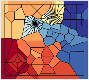
- Thiessen/Voronoi and Delaunay
- Point tools
- Polyline/Polygon tools
- Table tools
- Buffer ... Geometry Mysteries
- Point in Polygon ... Geometry Mysteries
2019
- Geometry in NumPy
- Geometry, Arcpy and NumPy
- Deconstructing poly* features
- Reconstructing poly* features
- Attributes.. the other bits
- Don't believe what you see
- Geometry: forms of the same feature
2018